Confederation Bridge Photos

The Confederation Bridge (1997) (12.9 km) crosses the Northumberland Strait between Prince Edward Island & New Brunswick in Canada. It is designed to resist ice flows.

Click thumbnail to enlarge. F11 to view website full screen.
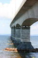
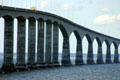
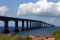
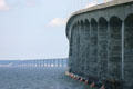
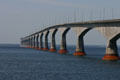
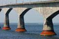
Confederation Bridge to PEI curves across the straights to the Island. PE.Buttresses against ice & spans of Confederation Bridge to PEI. PE.Central sections of Confederation Bridge to PEI to allow ship traffic. PE.Confederation Bridge to PEI view of length. PE.
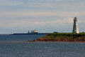
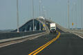
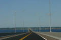
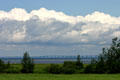
Lighthouse & ship at end of Confederation Bridge to PEI. PE.Road of Confederation Bridge to PEI arches upward over shipping spans. PE.Confederation Bridge to PEI road descending to Island. PE.Confederation Bridge to PEI seen across farm fields. PE.
Confederation Bridge to PEI. PE.Spans of Confederation Bridge to PEI. PE.Spans of Confederation Bridge to PEI. PE.

See Also:

All photos on this page are originals by & copyrighted by Jim Steinhart.
All rights reserved. Permission required to use.

CMP